
A Flexible FHWA Traffic Noise Model UI Featured at the Esri UC
/The Federal Highway Administration (FHWA) has been using the Traffic Noise Modeler (TNM) 2.5 since the late 1990s. While this product served the FHWA well, they wanted to create a new product that would enhance the usability, beautify the user interface (UI) experience, and update the underlying noise model libraries to a .NET language. Not only did GeoDecisions build a new standalone UI for the FHWA, we wanted to provide even more functionality in a roadway engineer's native tools. We designed and developed three additional tools to meet this goal.
Technical Design
In order to develop all projects using the latest frameworks, we chose .NET 4.5 as the standard. For the main standalone application UI, we used a combination of available libraries and 3rd-party products. In addition, we used Windows Presentation Foundation (WPF) to prototype and design in a fast and agile manner. Since WPF supports shared templates, styles, and colors, we also were able to maintain a consistent look and feel.
The WPF Extended Toolkit was a huge benefit, since we required support for numerous customizable datagrids and property windows - some of the most used UI features - for data entry, result display, and object property editing.
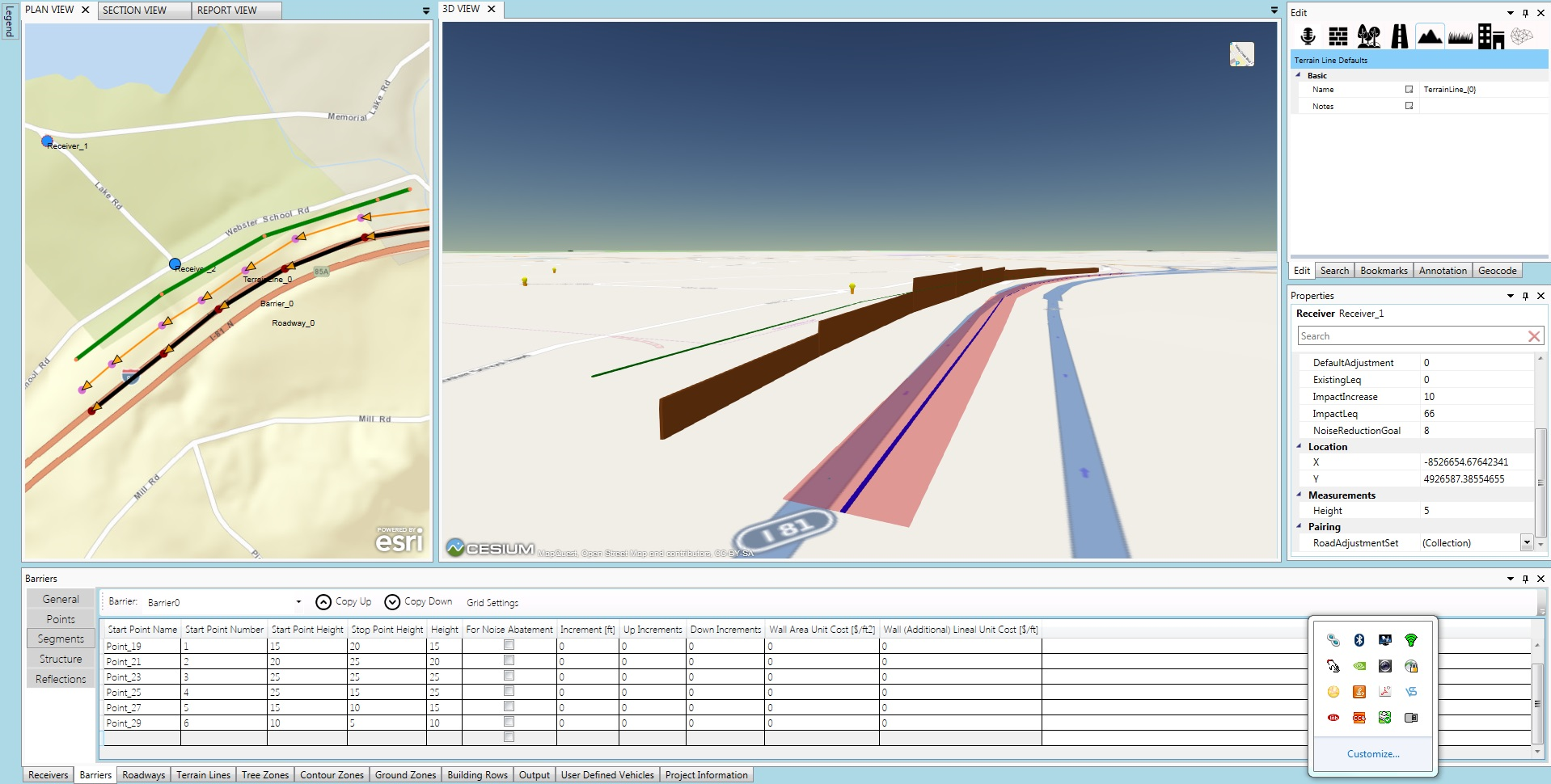
We also used a docking manager to facilitate the UI windowing and help keep the application customizable to the user. We utilized an embedded chromium browser for the 3-D view, and use its Web GL support to render the 3-D view . For the section view, we used a charting library to plot data on the screen. The plan view is built using a map from the Esri® WPF Toolkit. We also added custom features to the map and tools that end users have at their disposal.
Main UI Views
Using the new UI, FHWA staff is able to visualize data in a more robust environment. For the 2-D plan view, the underlying background can be a custom tile set, any Esri online map (web mercator), or a solid color background map. This allows the FHWA to use a real geographically referenced project to compute traffic noise. In addition to the 2-D plan view, our 3-D view has three different base maps options. Users also can view model objects in 3-D space, enabling better spatial awareness and visualization of the noise wall barriers, receivers (simulated ear location), roadways, and numerous other objects.
Last but not least, we consider section visualizations. In the section view, users can draw a line through the plan view and the application will generate a section view of the objects – an excellent way to visualize changes in terrain and height of objects in relation to one another. The user also can manipulate the view by zooming and panning. This allows viewing greater detail, particularly for a larger project.
Learn More
If you are attending the Esri User Conference in San Diego, be sure to see Kevin Switala, GISP, (GeoDecisions) and Ahmed El-Aassar, PhD, (Gannett Fleming) present this project during the "Project Planning/Environmental Review for DOTs" session on Wednesday, June 29, from 8:30 a.m to 9:45 a.m. in Room 27 B of the San Diego Convention Center.
Also stay tuned for more on FHWA UI features and TNM extensions.


