
Decades of GIS Excellence with Hanover County, VA
/GeoDecisions’ latest three-year Hanover County, Virginia, contract award – a new cross-platform JavaScript application that upgrades the county’s mapping interface - extends Hanover County’s status as GeoDecisions’ longest continuously running client.
A public-facing web map application that utilizes dynamic feature services, JavaScript empowers end users to display building address, floodplain, historic site, urban service area, and zoning information throughout the county. It also enables connections with resources available on the Esri® platform.
For more than 20 years, GeoDecisions has partnered with Hanover County to evolve their geospatial applications and “provide citizens and businesses with the tools to obtain pertinent data anytime, anywhere, and on any device,” said Kevin Nelson, information technology director with Hanover County.
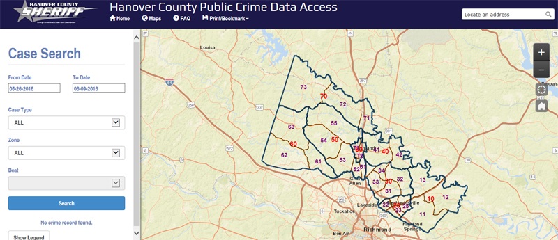
Shown above, GeoDecisions deployed a Hanover County Sheriff’s crime statistics mapping application in 2015. Moving forward, Hanover County is considering additional GeoDecisions GIS applications to help with capital improvement planning.


