
PennDOT’s One Map for Transportation Project Planning
/CLIENT: Pennsylvania Department of Transportation (PennDOT)
LOCATION: Pennsylvania
“GeoDecisions really listened and understood our business needs in developing One Map. The management and implementation of the project was vital to its success, given the number of stakeholders and size of the project. Having GeoDecisions as a partner helps PennDOT stay at the forefront of application development, with products like One Map.”
CHALLENGE
PennDOT needed to redesign an outdated Multi-Modal Project Management System Interactive Query Tool (MPMS-IQ), which served as their public-facing portal for the Four-Year Transportation Improvement Program (TIP) and the Twelve-Year Program (TYP) data. The new version of the application needed to bring together a variety of data, increased functionality, and an expanded user base.
SOLUTION
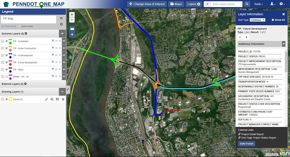
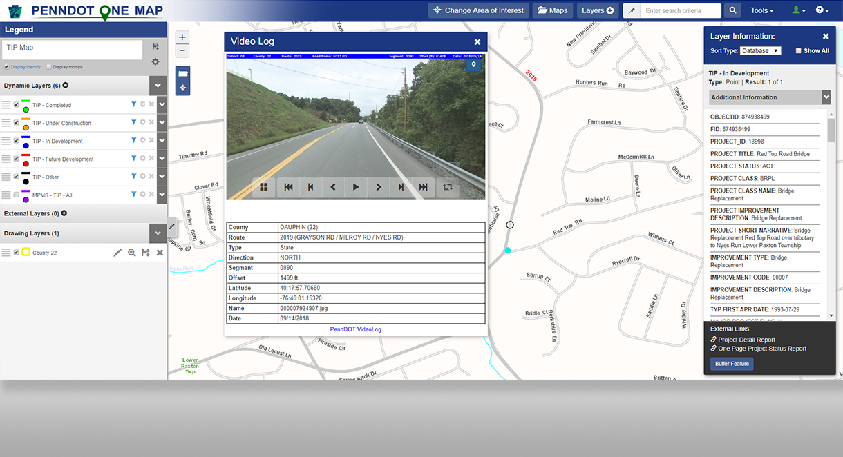
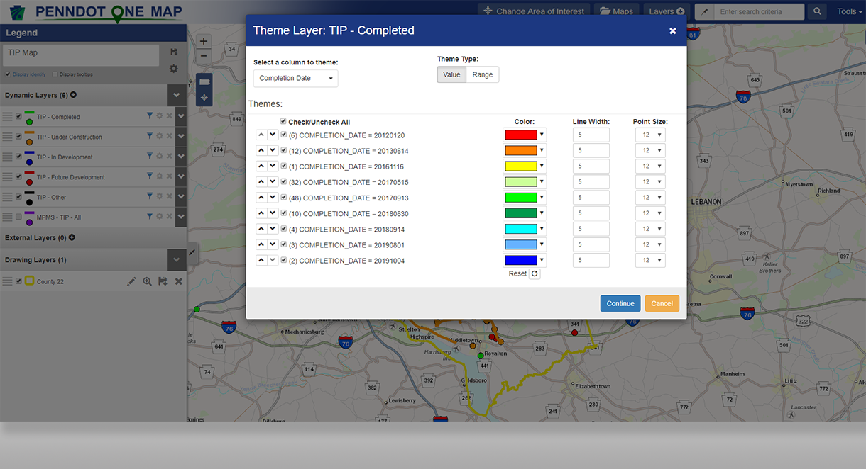
Designed, developed, and implemented by GeoDecisions, PennDOT One Map (One Map) is an Esri®-based GIS mapping application that provides the data required for the TIP and TYP. It is also a portal, centralizing numerous geospatial data layers within PennDOT, including Transportation Systems Management and Operations (TSM&O) data.
PennDOT One Map fulfills the needs of the district, county, and central offices for PennDOT staff in addition to planning partners and public users, allowing them to electronically assess data, as well as to view, create, and share maps online. As a web-based application, One Map delivers a uniform method of data validation and output for users of the system sitting on a single data model.
By integrating the needs of TSM&O, PennDOT improved overall safety and operational needs with a better view of congestion, safety, and department assets data included in three systems maps. These maps address the three types of congestion: Recurring Congestion, Unplanned Non-recurring Congestion, and Planned Non-Recurring Congestion. The maps assist the Regional Traffic Management Center (RTMC) regions in the development and update of their Regional Operations Plans.
Key features include:
Ability to filter map layers.
Ability to theme layers based on data groupings.
Area of interest search.
Custom map generation.
Drop-down menu-driven search.
Extensive data/layer catalog.
Large scale printing.
Map save and share.
Robust data grid interacts with map layers.
KEY RESULTS
Re-platformed system to newer technology, which improved functionality and speed, and reduces costs for future modifications.
Improved access to TSM&O data, which supports more efficient development and update of RTMC Regional Operations Plans.
KEY TECHNOLOGY
AgularJS
ASP.NET Web API
Bootstrap 3
Dapper
ESRI® ArcGIS® Platform (ArcGIS Server and ArcGIS API for JavaScript)
MapCore Platform
Oracle Spatial


