
Comprehensive Data Checks Move Utility to ArcGIS Utility Network
/Client: North Wales Water Authority
Location: North Wales, Pennsylvania
CHALLENGE
With ArcMap fading out in place of the new ArcPro, the North Wales Water Authority (NWWA) was faced with a challenge: the technologies and workflows of their existing asset management solution would soon be outdated. As a part of this new management system, their geometric networks needed to be replaced by the Utility Network, which required updated data in order to operate. Faced with these challenges, NWWA sought the right expertise to guide their transition to a new management solution.
SOLUTION
After reviewing NWWA's IT systems, GeoDecisions determined that NWWA needed to determine the health and readiness of their data for use in the Utility Network and the additional outage solution functionality provided by the Utility Network. Through this process, GeoDecisions helped NWWA develop the appropriate resources, tools, and processes required to transition them to Utility Network, ultimately evolving them toward an asset management solution aligned to services-based architecture. GeoDecisions provided comprehensive data checks to make sure NWWA's data was clean, unbroken, free of nulls, and configured for the next level of Esri offerings.
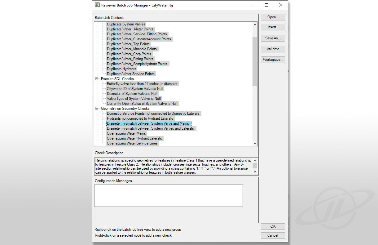
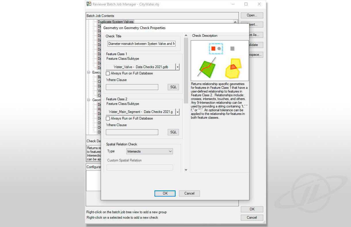
To begin transitioning NWWA's data to the Utility Network, GeoDecisions reviewed their water distribution GIS, focusing on topology, feature, and attribute integrity. To be considered ready for import into Utility Network, the GeoDecisions' team ran ArcGIS Data Reviewer checks. Additionally, the team primed NWWA's IT infrastructure to run future edits and updates and maintain the system's quality control through its lifetime. These initial steps are essential because process and procedure, definition, and refinement maximize quality assurance from the very beginning.
As a water utility, NWWA had specific focus areas for this effort. To start, they needed to define their assets in preparation for use with an asset management program. For pipe segments, this meant eliminating unnecessary short segments, vertices, and connectivity, such as crosses or overlaps. The client also needed to determine critical attributes for all assets' size, type, install year, and operability. The completeness and connectivity of point and line features, including valves, fittings, and structures, were essential throughout this process. NWWA had specific data check needs, including crosses and overlaps, fittings and valves, hydrants, pipe segments, blow offs, and topology. The GeoDecisions' team ensured clean data for a smooth transition to the Utility Network by reviewing the client's existing data and attributes.
Once established, the Utility Network workflows and tools are used for trace-flow modeling, asset management, and condition assessment. Our health checks and subsequent activities support the connectivity, detail, and logic of the data features and are key to creating and sustaining the network's intelligence.
KEY TECHNOLOGY
Esri ArcGIS Enterprise Portal
Esri ArcGIS Server
Esri ArcMap / ArcPro
ArcGIS Data Reviewer Extension
Esri ArcGIS Utility Network
KEY RESULTS
Developed a data quality matrix to help the client determine the status of their data, identify null values, and find where records were unpopulated.
Trained NWWA employees on how to package checks to save time, money, and resources on quality assurance/quality control (QA/QC).
Created a more efficient QA/QC system, allowing NWWA to run effective data quality checks.
Learn more about our Esri Support Services.


