
National Renewable Energy Laboratory Localized Charging Assessment Tool and Estimator
/Pilot Project Provides Electric Vehicle Supply Equipment Cost Estimation and Geospatial Mapping
Client: National Renewable Energy Laboratory
Location: Nationwide

Challenge
The federal government is taking the lead in the nation’s transition to electric vehicles (EV) with an executive order from the Biden Administration to transform the federal vehicle fleet of 600,000 cars and trucks to zero-emission vehicles powered by carbon pollution-free electricity. The goal is 100% acquisition of zero-emission vehicles by 2035, including 100% light-duty acquisition by 2027. This policy is estimated to reduce the federal government’s greenhouse gas emissions by 65% by 2030 and achieve net-zero discharges by 2050.
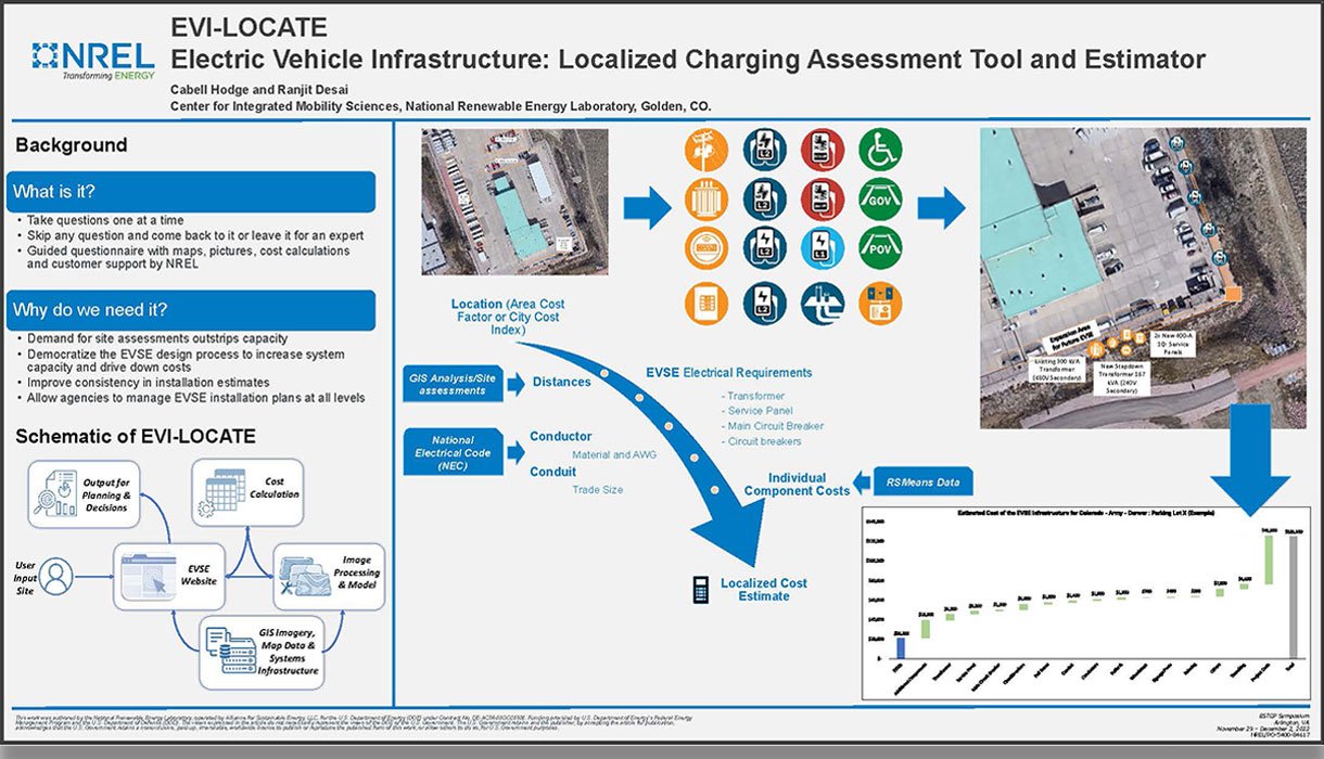
Localized energy infrastructure planning at governmental facilities is already underway. The development of tools for agencies and facilities, called cost estimation for EV supply equipment (EVSE), can determine fast charging station locations and designs, power requirements, and prices.
Solution
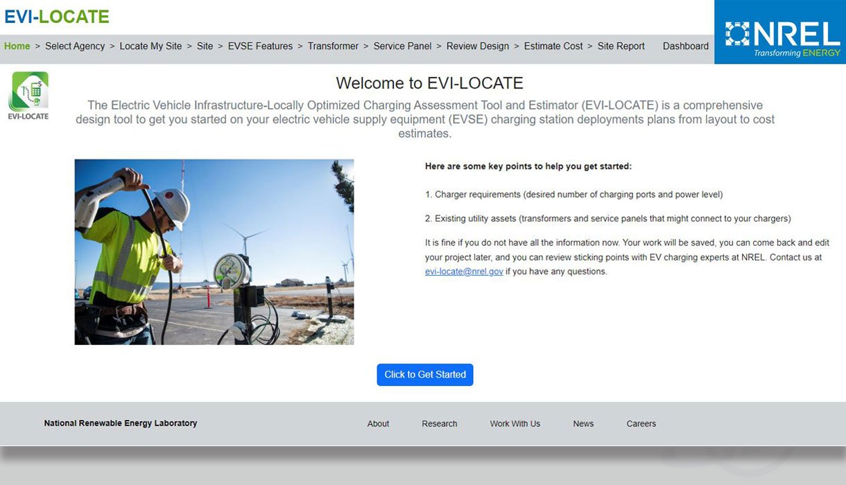
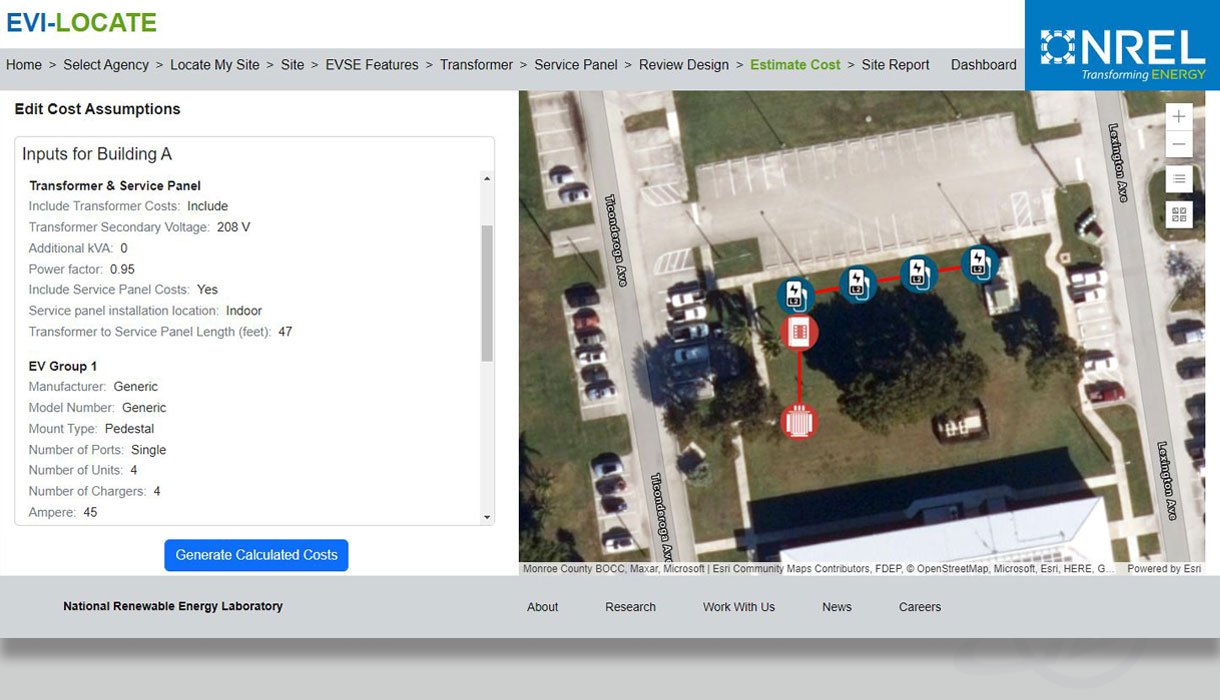
GeoDecisions partnered with the National Renewable Energy Laboratory (NREL) and other federal agencies to design the Electric Vehicle Infrastructure: Localized Charging Assessment Tool and Estimator (EVI-LOCATE). This solution assists federal entities with EVSE installation cost estimation. EVI-LOCATE is an interactive web-based application that leverages custom geographic information systems (GIS) tools, available air photos (real color, infrared), and existing data layers (utilities, street networks, parcel layers, building footprints, etc.) to help pinpoint EV charging stations based on a selection of user-input information.
The solution includes:
Modeling to identify hardscape, softscape, building impediment, and other features that impact the optimal location and costs associated with EVSE installation.
Piloting the model on at least four federal sites to identify success criteria.
Completing quality analysis (QA) and quality control checks (QC) to determine the suitability of the model output (potential iterative cycle).
Using imagery from the National Agriculture Imagery Program to complete the identification analysis using the model throughout the U.S.
Publishing the tool on NREL infrastructure and making it immediately available to the federal fleet and the public.
Providing support to NREL to advance fleet electrification efforts.
EVI-LOCATE aims to empower fleet and facility managers to gather cost estimates based on ESVE designs and prioritize them based on available funding sources. The solution will help create layouts that determine the number of chargers, costs, and locations to connect EV infrastructure across the facility.
Budget factors built into the estimation calculation include:
EV battery plug type.
Charging station capacity.
Electric cable length.
Impacted surface repair.
Cost components include:
Electrical equipment (e.g., circuit breakers and service panels).
Conduits.
Conductors.
Bollards.
Signage.
Installation.
Networking.
Warranty.
Site validation.
Activation.
Permit costs.
As a division of Gannett Fleming, GeoDecisions can partner with other departments to increase our value to our clients:
GeoDecisions is responsible for the model development, data analysis, and testing components.
Management Consulting performs the QA/QC and energy analysis components.
Valuation & Rate tracks and updates the cost of digging and repairing different surface types.
Key Technologies
Esri® ArcGIS Enterprise.
Esri ArcGIS Deep Learning Libraries.
Esri Python APIs.
Esri ArcGIS Living Atlas.
Key Results
An interactive web-based application to help localized EV charging assessments based on user input information.
Assisting NREL in achieving the zero-emission federal fleet executive order through a pilot program.
GIS integration leveraging Esri technology and available data layers, resulting in more accurate cost estimates.


