
Esri Middle East and North Africa User Conference
/GeoDecisions and Gannett Fleming staff were honored to be part of the action during the Esri® Middle East and North Africa (MENA) User Conference from November 17 - 19, 2015, at the Abu Dhabi National Exhibition Centre, UAE (#EsriMENAUC).
(Day 1) - Proud to be Awesome!
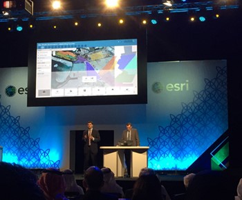
GeoDecisions developed Abu Dhabi Urban Planning Council applications featured during Esri MENA UC plenary.
The first day did not disappoint the avid GIS professional, accompanied by terrific weather and an impressive venue. To kick things off, attendees enjoyed an Esri video continues their “call to arms” for GIS professionals everywhere around the globe to increase our engagement when addressing global challenges.
Evolve, Collaborate, Innovate
Esri Founder and President Jack Dangermond followed this rousing video by delivering a rousing presentation emphasizing the ongoing evolution of GIS from the past as systems of records (i.e., desktop and client-server architectures) to emerging systems of engagement. As GIS becomes pervasive, interaction of many different user groups becomes constant, even without many users realizing they are part of the GIS ecosystem through their use of mobile apps and social media. Jack asserted that Web GIS is a transformation platform operating as a collaborative organizational structure - quite a concept to stress in the Middle East. In his mind, GIS creates and facilitates new connections across organizations via an open platform for collaboration and innovation.
Subsequent demonstrations supported this conceptual framework for GIS and the ArcGIS platform applications by demonstrating a multitude of interesting Esri product applications.
GeoDecisions Projects in Plenary
In fact, multiple example projects emphasized in the plenary were built by GeoDecisions… we really were proud to be awesome! This was especially true when Naeema Al Zarouni, the president of our UAE business partner, GeoLinks, demonstrated two innovative solutions we collaboratively developed for the Abu Dhabi Housing Authority (ADHA). Leveraging ArcGIS for Server and ArcGIS Online solutions, we are helping to transform the way ADHA operates and makes decisions. The Complete Emirate Community offers executives a dashboard measuring and depicting the various key performance metrics used to evaluate their ongoing operations, while the Emirate Neighborhood Decision Support Model supports their complex land and house bank planning process through the use of innovative and interactive raster modeling techniques.

(Day 2) - The Best GIS Practices in the World
The second day of the Esri® MENAUC offered technical workshops showcasing what's new in Esri technologies, in addition to some of the best GIS practices applied throughout the world.
AppStudio for ArcGIS: creates one environment that can be used to create one native app for Android, iOS, Windows, MacOS, and Linux.
Web AppBuilder for ArcGIS: features more than 30 widgets that can be easily configured with a developer edition to create custom widgets and themes.
ArcGIS 3D Analyst and Esri CityEngine: generate 3-D data by using building height attributes and complex procedures through CityEngine to help check what buildings are violating zoning regulations, for example.
3D Urban Analysis: extend routing capabilities to find a route from a certain point in the map, navigate through roads, reach a specific point inside a building.
(Day 3) – Helping Organizations Overcome Obstacles
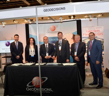
GeoDecisions team from left: Osama Asa'd, MCP, MCTS, GIS developer; Nijood Zarefa, PMP, GIS analyst; Hazem Barakat, PhD, Abu Dhabi general manager (Gannett Fleming); Kevin Switala, vice president; Robert Marsters, international director; Ohan Oumoudian, senior developer
On the third day of the Esri® MENAUC, our team enjoyed workshops focused on using technology to help organizations overcome challenges.
Survey123 for ArcGIS: provides the ability to visualize survey data on a map, analyze data, and understand field conditions, detect patterns, and make better decisions.
Big Data and Analytics: provide users with the ability to filter, organize, and analyze big data in a way that reveals patterns, trends, and relationships that reports do not. GIS Tools for Hadoop is a toolkit example intended for big spatial data analytics to leverage the Hadoop Framework for spatial data analysis. ArcGIS GeoEvent Extension for Server provides ability to incorporate real-time information streams with the existing GIS data and IT infrastructure.
ArcGIS Pro: provides tools to visualize, analyze, compile, and share data, where project resources are located in one place. Pro provides incredible capabilities for performing analyses in a 2-D and 3-D environment, including geoprocessing, raster, and statistical analyses.


