
USTRANSCOM Combat Logistic Challenges, Leveraging Geospatial Technology
/
Whether it is the transport of cargo, hazardous materials, or personnel, the ability to effectively manage logistics and transportation security is critical. In today’s data-rich environment, the challenge is finding an automated, user-friendly information platform that can integrate available data and technical applications together in a common operating picture (COP).
Command-and-Control Solution
To combat this challenge, the United States Transportation Command (USTRANSCOM), a unified command of the Department of Defense (DoD), has implemented GeoDecisions’ award-winning IRRIS platform, an innovative Web-based portal to worldwide infrastructure and near-real-time data. Headquartered at Scott Air Force Base, Illinois, the USTRANSCOM Military Surface Deployment and Distribution Command (SDDC) oversees land and sea DOD transportation operations.
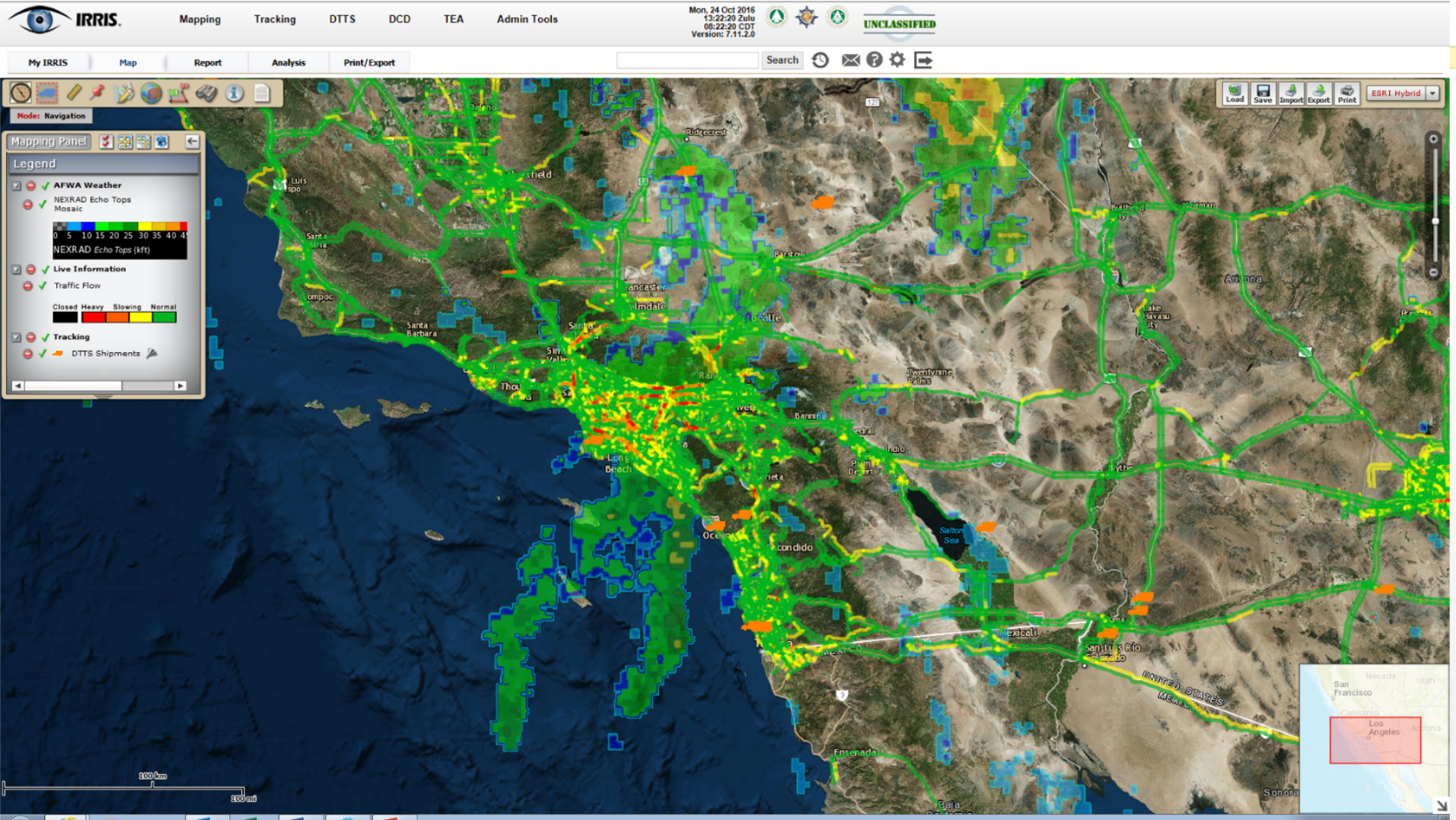
SDDC uses IRRIS to support enhanced situational awareness and expedite emergency response. The portal incorporates the latest advances in GIS technology and location-based services to aid in managing assets and tracking equipment. IRRIS displays worldwide infrastructure data, live-vehicle tracking, weather, and route conditions.
PinPoint Tracking
Through its integrated Defense Transportation and Tracking Service (DTTS) functionality, IRRIS helps the SDDC provide transportation security for more than 50,000 Arms, Ammunitions, and Explosives shipments per year throughout North America. The DTTS application enables users to share a COP with command centers and service partners to:

Provide automated alerts when a shipment is delayed, goes into a secure hold status, or has an emergency.
Immediately map an incident and provide the nearest military and 911 emergency response locations and contact information.
Calculate Net Explosive Weight on the truck/trailer and provide area of risk analysis.
Provide accurate turn-by-turn, address-to-address, or latitude/longitude driving directions with total drive, mileage, and maps.
Geofence critical areas by geography, route or weather pattern and return trucks within the affected area.
Emergency Response Use Case
DTTS provides personnel with a level of transparency for everyday oversight, or to quickly view asset locations and effectively respond to emergency situations. Satellite communications provide in-transit visibility for the shipping of sensitive cargo. Continuous updates are provided directly from fleet in transit, which enables tracking, monitoring, and communication capabilities to promptly adapt to unexpected situations.
"DTTS is just one of the many ways the trusted professionals of SDDC deliver readiness," said Maj. Gen. Kurt J. Ryan, SDDC commanding general. "It's a critical function in SDDC's support to DOD and the warfighter." Read more about how SDDC was used to aid with a North Carolina emergency response scenario.


