
Supporting the IIJA Grant Management Lifecycle with GIS-Enabled Tools
/
In this second installment of a four-part IIJA grant management solutions blog series, learn how GIS-enabled tools increase efficiency for transportation projects throughout the IIJA grant management lifecycle. The first installment is available here.
Federal highway programs will receive additional funding through the Infrastructure Investment and Jobs Act (IIJA), also referred to as the Bipartisan Infrastructure Law (BIL).
The Federal Highway Administration (FHWA) continually adds information about how individual states can receive funding through various competitive grant programs. Already, transportation agencies across the country spent the summer of 2022 working on applications for IIJA grant opportunities.
Now is the time to get up-to-speed on the grant management lifecycle.
Available IIJA Transportation-Specific Grant Funding
The FHWA regularly provides resources regarding the transportation specifics of the IIJA and available grant programs. Some of the recent information includes:
$59 million in Commuter Authority Rail Safety Improvement (CARSI) grant awards.
ATTAIN Notice of Funding Opportunity (NOFO).
National Electric Vehicle Infrastructure (NEVI) program.
As of Sept. 6, 2022, the U.S. Department of Transportation (DOT) has announced $118.5 billion in IIJA grant funding. As states await more award announcements over the coming weeks and months, they must prepare to hit the ground running on their grant-funded projects.
Since the 1990s, federal transportation policy has assigned more responsibilities at the state level when it comes to grant management. State DOTs must have strong oversight of their grant projects, sub-grantees, and project finances. This oversight is needed throughout the grant lifecycle, from the pre-award, post-award, and close-out phases. One can imagine the time and staff resources needed for this level of oversight on a complex transportation infrastructure project that costs more than $1 billion.
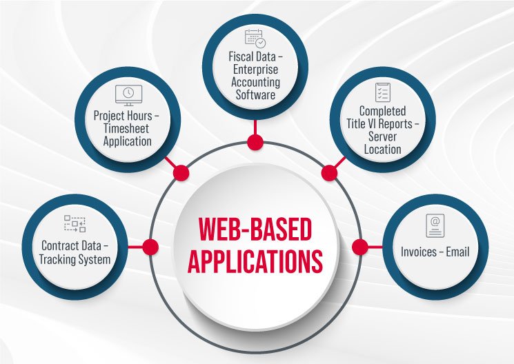
To address these increasing requirements, state DOTs have seen benefits in web-based applications that help streamline their processes. These systems can help free up staff time from administrative tasks and processing so that they can focus on program management and providing technical assistance to their sub-grantees and stakeholders.
By its nature, grant management is procedural. Application development teams gravitate toward a clear process to build a web-based management system. Systems can be programmed to:
Replace paper processes.
Enable stakeholder access and collaboration.
Enforce business rules to ensure critical steps are completed.
Capture key performance data to support overall DOT program management.
Grant Management Lifecycle
The grant application is just one of seven stages in the grant management lifecycle for a state DOT. The IT tools that support the grant lifecycle at state DOTs are often disparate and don’t interface with each other. For example, the system that handles the money doesn’t talk to the system that manages the preliminary engineering plans or the construction progress tracking tools.
At GeoDecisions, a division of Gannett Fleming, we have completed several projects for DOT clients to meet these data integration goals. Many companies advertise commercial-off-the-shelf (COTS) or out-of-the-box grant management tools, making them look like a silver bullet that will answer every grant management need. However, these tools rarely meet the complex and unique requirements of large, complicated transportation projects. State DOTs have existing systems that rarely plug and play with these out-of-the-box solutions.
GeoDecisions’ understanding of DOT business processes allows DOTs to make the most of the existing investments in their legacy systems. For example, GIS visualization tools and data integration projects make reporting and monitoring easier for the DOT’s grant managers.

Implementing GIS Systems for Grant Management

DOTs receive additional benefits when these grant management systems are integrated with geographic information systems (GIS).
Adding a spatial component to these applications can allow DOT decision-makers and their teams to visualize their investment, deploy GIS field applications to track onsite visits, and monitor efforts often required on federal grant-funded infrastructure projects.
One of the major challenges to the ultimate implementation of a successful web-based system is the gap of understanding between the DOT business teams and the technology experts who make the IT magic happen.
Just like different stakeholders might have different ideas about addressing a transportation project’s purpose and need statement, the business and technical teams might have varying ideas of what a grant management system should look like.
A best practices report from the National Cooperative Highway Research Program, which interviewed several state DOTs that had implemented or were in the process of implementing a web-based grant management system, made several recommendations. These recommendations include:
Invest in thoroughly documenting their business processes.
Engage stakeholders early and often.
Work with application development teams and vendors that are familiar with grant management.
Web-Based Grant Management Solutions
Grants tend to have clear procedures, but, as we know, the rules will change. If designed correctly, web-based systems can be built to change as the business rules change.
GeoDecisions implemented a “change will be needed” strategy when we partnered with the Pennsylvania Department of Transportation (PennDOT) to develop the PennDOT Connects collaboration portal. This project sought to provide PennDOT with a better way to collaborate with its planning partners and streamline the project initiation process.
To meet these project goals, the GeoDecisions team designed an innovative platform that allowed PennDOT to fully customize their web forms and define system workflows without the need to reprogram the application with every rule and requirement change. The resulting application is the feeder system to the statewide transportation improvement program (STIP) project selection and prioritization process for PennDOT.
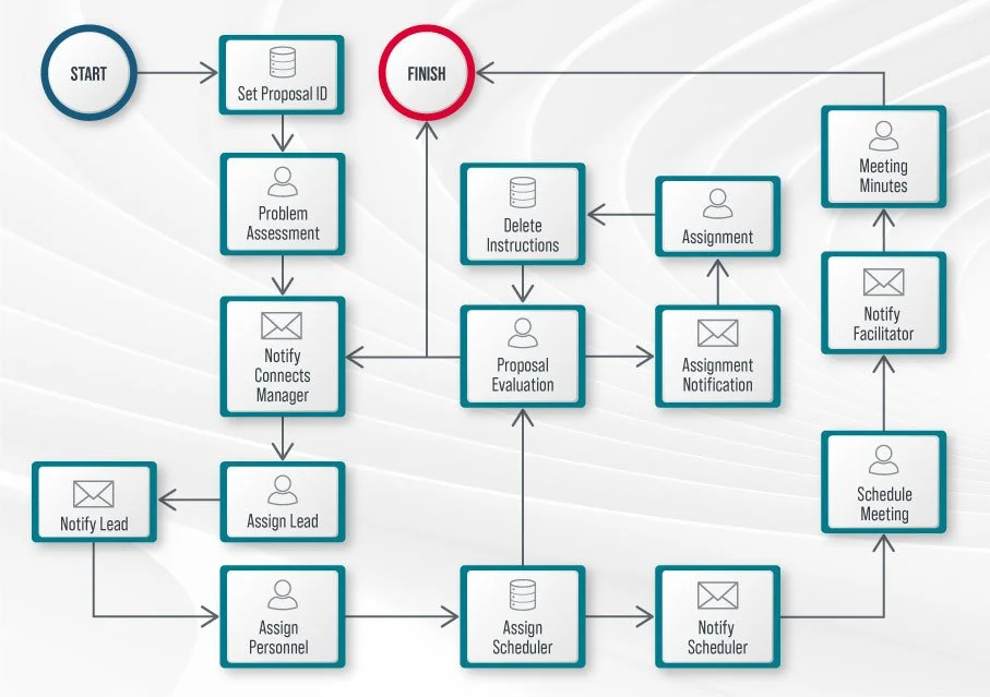
The PennDOT Connects application also supports the grant management system best practice of engaging with stakeholders early and often. The system has procedures that automatically notify and encourage engagement from each stakeholder at the appropriate steps based on their project role. Social networking and collaboration tools are also built into the PennDOT Connects platform to promote discussion, knowledge sharing, co-creation, and form completion.
“With the full scope of a proposed project at their fingertips, project planners are better able to consider all factors and issues that may impact the project, its delivery schedule, or budget – a key priority of the PennDOT Connects transportation planning process. Our team leveraged its deep understanding of the workflows and forms used by many DOTs to create a system backbone that we can adapt for other applications.”
State DOTs will need to meet reporting requirements throughout any funded project’s implementation. This reporting is also likely to have some data requirements that it has not historically had to track. To ease the reporting effort, many states are seeking to integrate their data across systems and are looking for consultants to help connect these complex systems.
The teams working on grant projects have many responsibilities. Grant management systems can help reduce the workload needed to meet reporting requirements by systematically enforcing compliance rules and ensuring grant recipients provide an accurate accounting.
Beyond the reporting requirements, it is also valuable for DOTs to see grant-funded project data alongside their more typical highway and multi-modal funds to get a full scale of their organizational impact on the communities they serve.
Simply put, using web-based applications can streamline processes, reduce redundancies, and create authoritative data environments.
Email Ohan to learn more about how we can help you create a custom solution for your IIJA grant management needs.
Stay tuned for the next blog in this series, which will focus on helping you meet the new tracking system requirements of the IIJA grant programs.
About the Author
Ohan Oumoudian
Senior Manager
Email Ohan
Connect on LinkedIn
Get to Know Ohan


