
PennDOT’s Guide Rail Management App
/“With the implementation of the PA Guide Rail app, guide rail activities such as repairs, upgrades, installations, and removals are captured by the foreman or inspector during or shortly after the completion of work. Updates to the Roadway Management System (RMS) with this new information occurs automatically. This results in time and cost savings, eliminating the need for personnel to manually enter the data in RMS. The PA Guide Rail app enables PennDOT to maintain a more accurate and up-to-date inventory of guide rail and end treatments within RMS.”
CLIENT: Pennsylvania Department of Transportation (PennDOT) Bureau of Maintenance and Operations (BOMO)
LOCATION: Pennsylvania
CHALLENGE
PennDOT’s BOMO needed to automate the process of tracking the damage, repair, and replacement of guide rails and end treatments. With guide rail activities occurring daily in the field, data was captured manually and could not adequately be tracked and monitored at the state level with the Roadway Management System (RMS). Reimbursements would take months because management could not easily ensure policy compliance.
SOLUTION
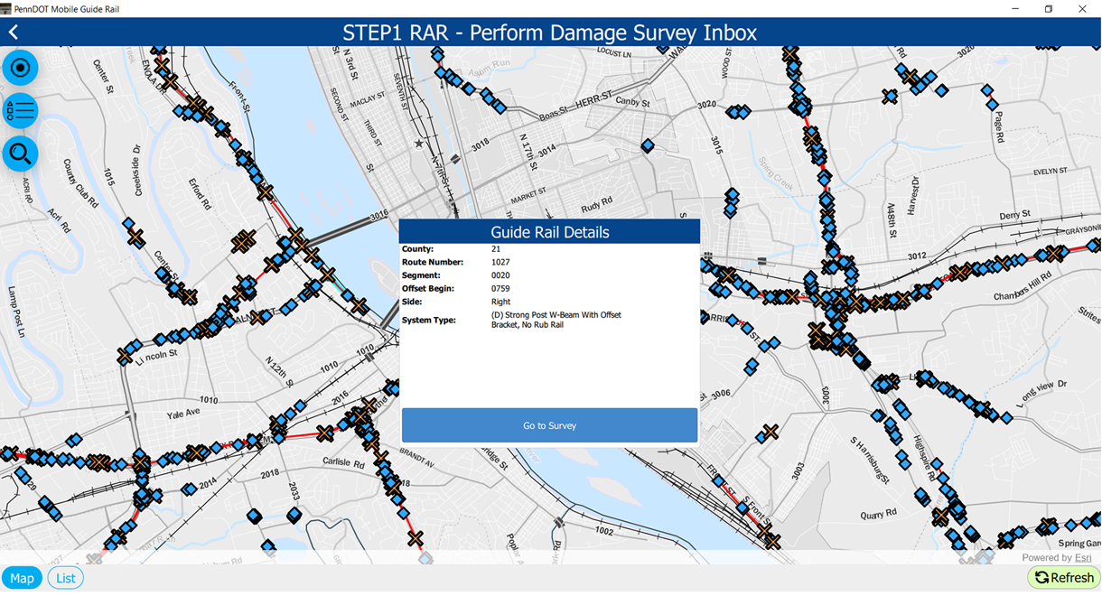
To provide PennDOT’s BOMO quicker, more accurate information about their guide rail data process, GeoDecisions extended Esri®’s Survey123 and combined it with Esri’s Operations Dashboard and BOMO’s RMS to create the PennDOT Guide Rail Management App. To give field workers improved visibility of their assets and workflow, we modified Survey123 to extend it from a data gathering solution to become a more immersive mobile workforce management tool – locating the correct asset, collecting damage images, and sharing information with the repair team.
Every guide rail repair is documented, with the information and images captured. Repair information is shared with inspectors who review the repair and document the changes to the sites, noting changes to the asset and the scope of the repair. The new mobile workforce management tool allows access by multiple users in different roles and responsibilities throughout the process.
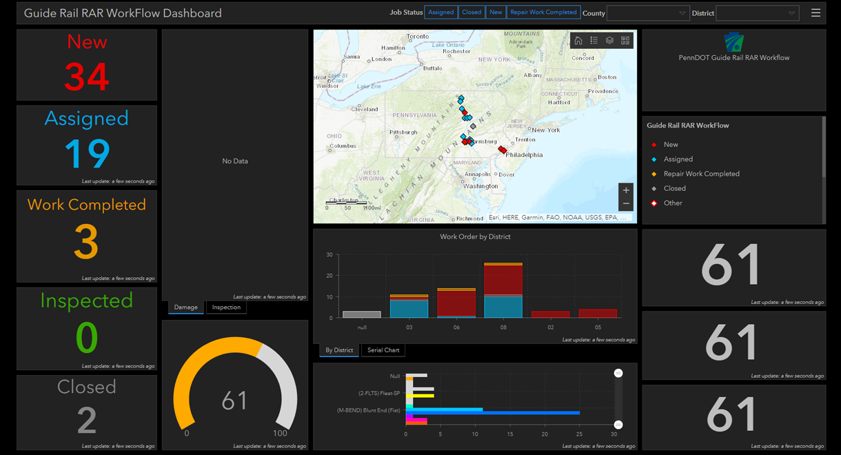
Locations are fed into Survey123 from RMS and changes and updates are sent back to keep RMS up to date. Users can select and survey the assets from an online or offline map using their iPads on location. The updates occur automatically online, allowing BOMO staff to monitor the status of the repairs and collection in real time using Operations Dashboard for ArcGIS.
KEY TECHNOLOGY
Esri ArcGIS Online + Operations Dashboard
Esri Survey123 + Extending Survey123 with AppStudio
Esri JS API
Angular
C#, ASP .NET Web API
Oracle Spatial


