
Modernizing Water System Data
/CLIENT: Pennsylvania American Water
LOCATION: Pennsylvania
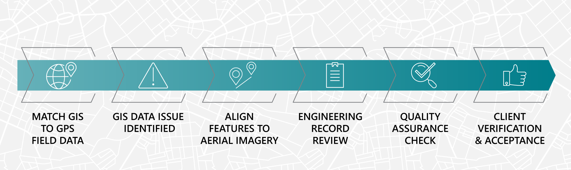
Project workflow for the GIS data development for PAWC’s asset database.
CHALLENGE
Pennsylvania American Water (PAWC) needed a more accurate way to manage the assets throughout its infrastructure. PAWC originally tracked the location of its assets, such as hydrants, street valves and water mains, with computer-aided design (CAD) drawings. The CAD files were a graphic representation of the system, based on paper maps created from field information without the precise location indicated. The uncertainty of asset location caused delays in response time to work orders.
SOLUTION
Under PAWC’s Spatial Data Accuracy Initiative, GeoDecisions converted PAWC’s assets from CAD to an Esri®-based model to create a 1:1 match of all GIS features, such as points, lines, and polygons to their asset database. Following an effort to capture the location of all the aboveground assets with precise GPS coordinates, our staff was able to adjust the subsurface water assets to the approximate spatial location.
Within the scope of PAWC’s initiative, we significantly improved the spatial accuracy by reducing the margin of error for GPS data collection to within one-foot. In addition, the attribute information (i.e., size, material, age, valve type, etc.) for all assets was improved by referencing the as-built engineering records. GeoDecisions completed these tasks for all water and some wastewater systems managed by American Water across Pennsylvania. With the system based in a GIS model, processes were automated to validate the data further and identify discrepancies.
KEY TECHNOLOGY
Esri Attribute Assistant Tool
Esri ArcMap 10.4
Esri ArcGIS Online Map
Esri Dashboard
Esri Mobile Collector App

Learn more about Water Utilities

Learn more about Asset Management Solutions


